New sensors were recently presented at the Intergeo 2023 exhibition in Berlin.
Vexcel introduced the new Merlin and Dragon sensors for its 20th anniversary.
Phase One, on the other hand, presented the new PAS Pana.
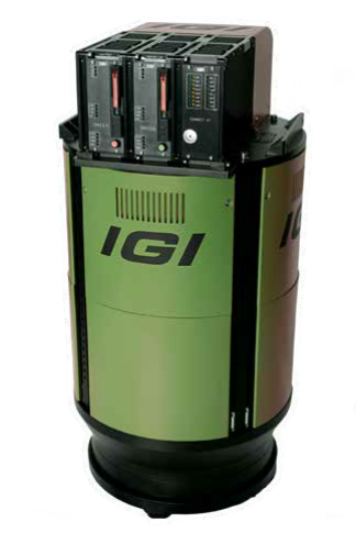
IGI, known for its oblique sensors, navigation and positioning devices, the new camera EcoMapper.

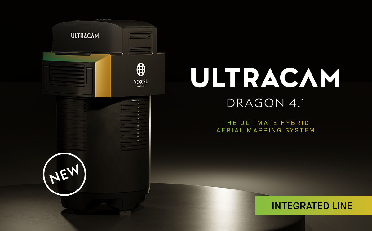
Vexcel UltraCam Dragon 4.1: hybrid oblique imaging and LiDAR system
the market’s most advanced, progressively designed, and seamlessly integrated hybrid aerial mapping system.
Designed for high-resolution mapping of complex urban environments and the creation of precise digital twins, the UltraCam Dragon combines the very best in imaging and LiDAR technologies for maximum collection productivity, high-accuracy and improved target coverage.
The Ultracam Dragon 4.1 produces high-resolution nadir and oblique aerial imagery enriched with precise elevation information obtained by a powerful 2.4 MHz RIEGL VQ-680 OEM LiDAR scanner, collecting up to 2 million measurements per second. The LiDAR’s innovative multi-axis scanning geometry, including a true nadir scan line, ensures maximum coverage of vertical features without occlusion in the steepest of building canyons and interior courtyards for truly impressive and complete digital twins. Two high-resolution nadir sensors (RGB Bayer pattern & NIR), along with four oblique (RGB) sensors, consistently deliver sharp, accurate and crisp imagery. This is achieved through advanced image processing techniques, including Vexcel’s proprietary Adaptive Motion Compensation (AMC) & True Pixel Processing (TPP).
The system marks Vexcel’s first hybrid aerial mapping system for deep insights into complex environments at highest collection rates.
The integrated Airborne Laser Scanner, a RIEGL VQ-680 OEM sensor from Austria, has been unveiled to the market at Intergeo in Berlin, with Vexcel being the first company in the world to integrate this cutting-edge LiDAR scanner into a turnkey solution.
The new Dragon 4.1 system will be available in summer 2024.
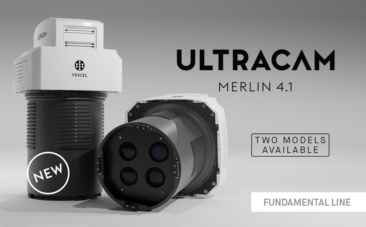
Vexcel UltraCam Merlin 4.1: fundamental quality redefined
an advanced camera system currently available in two models [2010 & 3020] serving as a gateway to professional aerial data collection.
Equipped with high-end Bayer pattern sensors, the UltraCam Merlin 4.1 meets the fundamental quality and accuracy standards demanded by professionals in the field. The system captures true nadir imagery at industry-leading geometry and best-in-class imaging performance. Paired with a sophisticated image processing chain, including proprietary solutions like True Pixel Processing (TPP) & Adaptive Motion Compensation (AMC), the Merlin 4.1 delivers precision results and raises the bar for excellence in its class.
The system is based on the 4th generation UltraCam architecture. It maximizes the collection window and drives down project expenses through a high dynamic range, a fast frame rate and an intuitive end-to-end software workflow. Paired with world-class support, customers can offer comprehensive mapping services to their clients while perfectly leveraging their investment.
The 2010 model is perfect for local projects, featuring two RGB and one NIR nadir sensor, enabling image capture at a footprint of 20,544 x 14,016 pixels. For larger projects, the recommended choice is the 3020 model, equipped with three RGB and two NIR sensors, significantly expanding the strip width to 31,300 x 14,016 pixels.
The system will be available on the market by end of 2023.
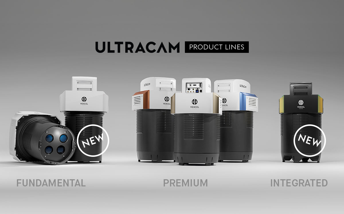
Vexcel’s new prodcut lineup
The product lineup now encompasses three distinct categories:
the Fundamental line, which consists of aerial cameras based on Bayer pattern sensors like the UltraCam Merlin 4.1;
the Premium line, comprising of the highly successful UltraCam Eagle 4.1, UltraCam Osprey 4.1, and UltraCam Condor 4.1 cameras with their established high-resolution panchromatic sensors; and
the Integrated line, showcased by the newly unveiled UltraCam Dragon 4.1. This cutting-edge hybrid aerial mapping system combines LiDAR and image sensors, providing advanced capabilities for integrated data acquisition.
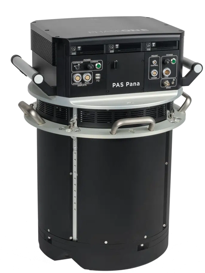
Phase One PAS Pana – wide area camera solution for geospatial mapping
The PAS Pana is a 7-camera wide-field camera system consisting of 5 RGB cameras with 150 mm lenses, and 2 NIR cameras with 70 mm lenses. It is a mapping system designed to provide effective performance in country-wide area mapping. Its large swath of 48,800 pixels allows to capture country-wide areas while keeping flying lines, hence flying time at the minimum.
PAS Pana offers various resolution options to suit diverse needs. It delivers exceptional high resolution at 2.5 cm Ground Sample Distance (GSD) for intricate details and up to 30 cm GSD for rapid wide-area coverage. This flexibility allows you to customize it to meet specific mission requirements, whether focusing on fine details or wide coverage.
PAS Pana also grants you full data ownership, freeing you from content program constraints. When paired with the entire iX Suite workflow, it ensures effortless data quality control from the outset. PAS Pana is fully integrated with iX Suite: iX Plan, iX Flight Pro and iX Process. iX Suite offers the most effective workflow and supports mapping projects from planning to execution and processing.
IGI EcoMapper
5 band aerial mapping system with build-in thermal camera
as soon as IGI provides a datasheet, I will integrate it into the GSD Calculator.


Cover picture: by courtesy of Geofly GmbH, Magdeburg, exhibition stand