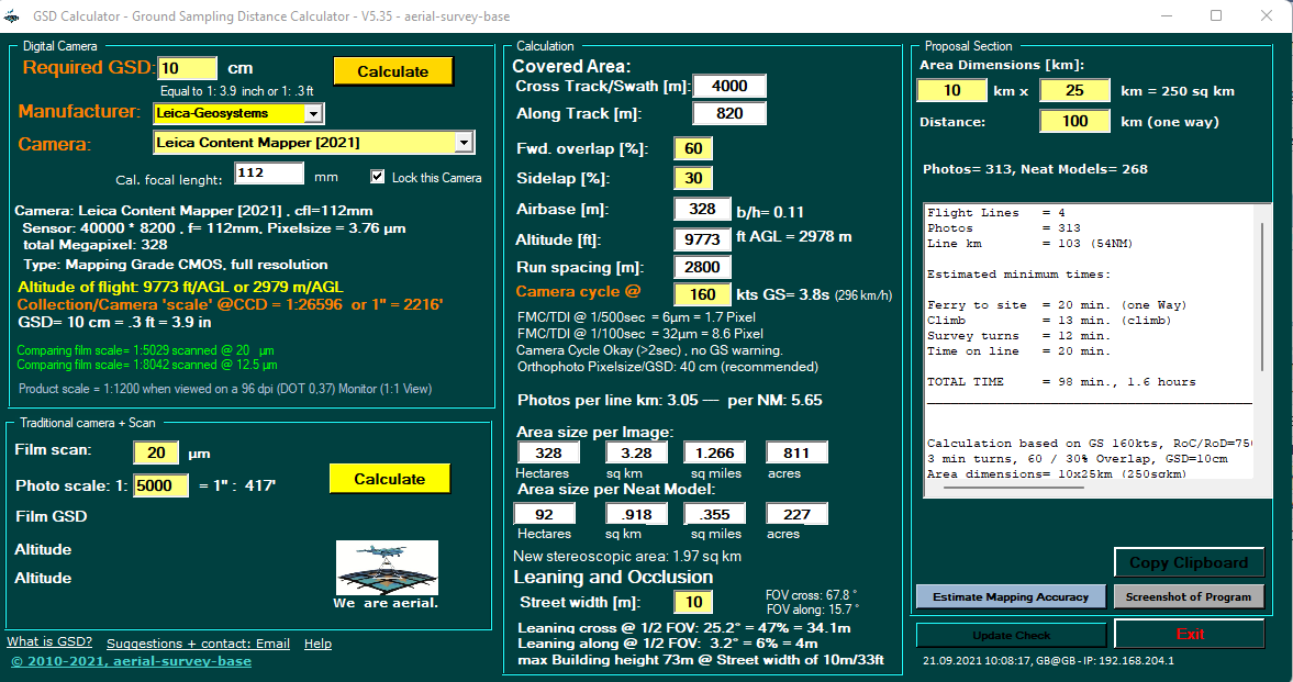
Leica released its new Leica Content Mapper at HxGN live & Intergeo 2021.
The Leica ContentMapper is an innovative and highly efficient airborne image sensor for large-scale geographic mapping projects. With 40,000 pixels in cross track, this latest-generation camera offers maximum performance in capturing high-resolution images and twice the image resolution with the same flight parameters compared to previous systems.
Specifically designed to maximize capture performance, the sensor features Leica Geosystems‘ latest technology designed for large-scale to nationwide imaging projects. Very well suited for the Hexagon Content Program.
With a frame rate of 0.8 seconds, the sensor is very well suited for high-speed turboprop aerial photography. The sensor is a backlit CMOS sensor, already used in CityMapper series (MFC150), as in many other cameras today. This also means a departure from traditional pan-sharpening principles, as we see in the Vexcel Imaging Osprey/Condor, the Phase One PAS880 or the IGI Urbanmapper.

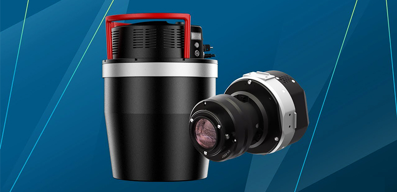
Vexcel Imaging unvails the Ultracam Condor 4.1 at Intergeo
The Ultracam Condor 4.1 is the all-in-one aerial camera solution for utmost efficiency of high-altitude, wide-area (nation-wide) data collection, featuring an expansive image footprint and impressive image quality.
With an impressive cross-track footprint of 48,462 pixels, the UCC 4.1 has a very wide, high-resolution RGB array resulting in a high flying efficiency. The new CMOS based Condor allows to operate with Jets & Turboprops due a frame rate of 0.7 seconds. It comes, similar as with UCO 4.1, with he innovative Adaptive Motion Compensation (AMC). Motion blur caused by multi-directional camera movements during the flight will be completely elimnated.
The image is made by combining a high-res RGB band + rectangular PAN & NIR images:
- RGB: 48,462 x 6,150 px @ f= 120mm
- PAN: 20,488 x 14,040 px @ f=52mm
- NIR: 9,456 x 6,240 px @ f=24mm
[PAN+NIR covers the RGB footpint by physical pixel size PAN 3.76 µm (L2 8.89 µm), physical pixel sizes NIR 3.76 µm (L2 19.27 µm)].