GSD Calculator v5.50 introducing Leica TerrainMapper-3
Leica introcuded their newest addition of the linear-mode TerrainMapper hybrid airborne sensor series.
The new sensor address applications from wide-area LiDAR down to the highest-density corridor mapping.
Featuring an adjustable (LiDAR) FOV up to 60°, new configurable scan technology and simultaneous matching-FOV imagery in four bands based on MFC150 backlight illuminated CMOS sensor.
The circle scan pattern enhances 3D modelling of lower-density urban areas or steep terrains, while the ellipse scan pattern optimises data capture in dense urban areas.
The skew ellipse scan pattern improves point density for infrastructure and corridor mapping applications, all three up to a PRR of 2 MHz.
The sensor seamlessly integrates with Leica HxMap’s end-to-end processing workflow, supporting users from mission planning to product generation to extract the greatest value from the data.
TerrainMapper-3 specs
- 14,192 x 10,640 pix, RGBN, 14 bit
- Image FOV: 61.3°
- LiDAR FOV: 10° – 60°
- IMU: SPAN CNUS5-H, Class 5, 500 Hz, FOG + NovAtel SPAN OEM7, 10Hz, RTK deeply coupled
- scan speed: 33-166 Hz
- scan patterns: circle, ellipse, skew
- wavelenght: 1.064 nm
- 15 Returns, 14 bit intensities
- gateless MPiA (Multi Pulses in Air)
- waveform recording incl.attributes
Note: from version 5.49 on I’ve changed the indication of the available resolution for Bayer pattern.
- CCD-Type designator for Bayer-pattern CCD replaced to reduce disadvantages for manufacturers using Bayer-pattern sensors.
The term „50% usable resolution“ it removed from Bayer-pattern driven sensors.
The changed designation is similar to the use of the term „True GSD“ a few years ago and may put some manufacturers at a disadvantaged position in certain circumstances. - I will comment on this „resolution issue“ in the blog when the opportunity comes.
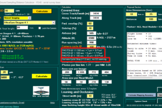
TrueGSD:
Dr. Karsten Jacobsen, Institute of Photogrammetry and GeoInformation at the University of Hanover presented a comparison of „GSD versus true GSD“ and why specially designed camera optics, such as those used in the Intergraph Z/I Imaging DMC, result in much better image quality and geometric accuracy than systems using off-the-shelf optics.