GSD Calculator 5.46 including Leica’s new flagship the CountryMapper published
DOWNLOAD your free copy of GSD Calculaor here
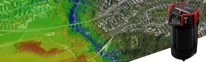
What will happen if you marry a DMC 4th generation with a TerrainMapper?
The result is an insanely innovative product – Leica’s new CountyMapper.
With over 31,000 pixels across swath, the sensor system provides superior capture efficiency for truly wide-area coverage.
A bunch of CMOS-based Leica MFC150 camera modules uses true mechanical forward motion compensation (FMC) to deliver industry-leading image quality, even at higher airspeeds, low altitudes and in challenging lighting conditions. RGB based, but complies fully with photogrammetric specs.
Collected data will be processed in Leica HxMap high-performance, multi-sensor workflow software for LiDAR and imaging data via one intuitive user interface with all the tools you need for calibration, colourisation, quality assurance, project reporting and 3D product generation.
The Country Mapper comes with built-in new Hyperion 3 LiDAR unit (Terrain Mapper uses Hyperioan2/2+) with 60 deg FOV and a PRR/PRF of 2MHz (2.000 kHz), that means:
- up to 15 returns, including intensity
- Full Waveform recording option at down-sampled rates
- Real-time waveform analysis and pulse extraction
- Multiple-Pulses-in-the-Air (MPiA): Up to 35 MPiA zones simultaneously
- Ambiguity resolution for targets in multiple simultaneous MPiA zones
- Gateless MPiA
technical data sheet will come soon.