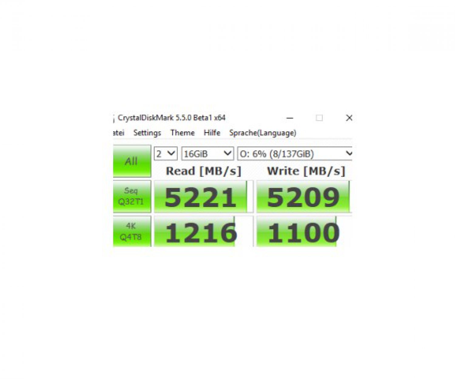
Which RAID level should I use? some guidelines to choose the right RAID level for your aerial mapping environment. in…
LiDAR, Light detection and ranging, airborne laser scanning, Laserscan
most frequently used:
Riegl LMS Q240, Q4800, Q680i, Q780, Q1560, VQ-1560i, including aoftware: RiAcquire data acquisition, RiAnalyze, RiWorld, RiProcess, RiHydro, RiMTA,
Leica Geosystems Airborne Laser Scanner ALS50, ALS60, ALS70, ALS 80
Teledyne Optech Eclipse, Gemini, Galaxy, Orion, Pegasus, ALTM, Airborne Laser Terrain Mapper,
Batyhmetric laser scanner:
Riegl VQ-880-G, RIEGL VQ-880-G bathymetric scanner, secchi depth,
Leica DragonEye, Leica Chiroptera™, Leica HawkEye™ III